Makalu Base Camp Trek 20 Days
Trip Facts
Group size
1-20+
Duration
20 Days
Trip Mode
Private Vehicle/ Shared Vehicle
Level of difficulty
Difficult
Max. Altitude:
5,000 m/16,732 ft
Best Season
Sep-Nov/Late Feb-May
Accommodation
Tea House/Lodge/Camp
Start/End
Kathmandu
Trip Highlights
- Trek duration: 20 days
- Explore remote and less crowded trail to Mt. Makalu (8,481m), the 5th highest peak in the world
- Stunning views of snow-capped peaks, glaciers, and alpine landscapes
- Trek through dense rhododendron and pine forests
- Experience unique Sherpa and Tibetan culture in local villages
- Opportunity to spot rare Himalayan wildlife like red pandas and musk deer
- Gradual altitude gain with proper acclimatization to reduce altitude sickness risk
- Mix of camping and teahouse stays for authentic trekking experience
- Relax in natural hot springs along the route
- Adventure for experienced trekkers seeking solitude and pristine nature
Overview
The Makalu Base Camp Trek is one of Nepal’s most remote and adventurous treks, taking you deep into the unspoiled wilderness of the Makalu-Barun National Park. Towering at 8,485 meters, Mount Makalu is the fifth-highest mountain in the world, and reaching its base camp (4,870m) is a journey filled with stunning contrasts lush rhododendron forests, terraced farmland, high alpine meadows, and the dramatic backdrop of the Himalayas.
Unlike popular treks such as Everest Base Camp or Annapurna Circuit, the Makalu Base Camp Trek offers true isolation, rich biodiversity, and authentic cultural encounters with Rai, Sherpa, and Limbu communities. This trek is best suited for trekkers who prefer less-crowded trails and are ready for a challenging yet rewarding Himalayan adventure.
Why Choose the Makalu Base Camp Trek?
This trek is for adventurers seeking a raw Himalayan experience. You won’t find crowds or luxury teahouses here—only serene nature, authentic villages, and breathtaking mountain landscapes. If you want to go beyond the mainstream Everest and Annapurna trails, Makalu Base Camp Trek is your ultimate off-the-beaten-path journey.
How does this trek start and end?
The typical itinerary begins with two days in Kathmandu for preparation, followed by the flight to Tumlingtar and drive to Chichila. Over the next several days, the route continues through Seduwa and Tashigaon, with an acclimatization stop at Khongma Danda before crossing Shipton La. After trekking through the Barun River Valley, trekkers reach Makalu Base Camp around Day 11 or 12, where an extra day is often spent exploring. The return follows the same trail back to Tumlingtar, with a final flight to Kathmandu. In total, the trek lasts about three weeks, depending on weather, group pace, and acclimatization needs.
Best Time to Trek Makalu Base camp trek?
The best seasons for the Makalu Base Camp Trek are spring (March to May) and autumn (September to November). Spring offers clear skies, warm temperatures, and blooming rhododendrons, while autumn provides stable weather and crystal-clear mountain views. Winter trekking is possible but difficult due to heavy snowfall, particularly on the high passes, while the monsoon months of June to August bring heavy rain, leeches, and poor trail conditions, making the trek unsafe.
Itinerary
After breakfast, we take a one-hour morning flight to Tumlingtar. Reaching there, we head north towards Khandbari after lunch. We will pass through a plateau for about 45 minutes. At Tumlingtar, we will meet our crew members and pack our bags and start to drive to Chichili, which will take us approximately 3 / 4 hrs. Chichili has a few houses inhabited by Gurungs.
Location:
Chichili
Meal:
Breakfast, Lunch & Dinner
Altitude Different:
1,980 meters
Accommodation:
Tea house / lodge
After leaving Chichili, we walk past forests, the Mani wall, and a dirty pond. We continue to walk along the ridge past a small stream to a single Sherpa house and tea shop. This is Mure, a spread-out village at 1980 meters inhabited by Sherpas and Rais.
Below Mure, the route cuts across the ridge, then make a treacherous descent to a rocky trail down to some stone steps and a final walk to Num (1490m). Num is situated on the ridge above an S-shaped bend in the River Arun, a picturesque village with lush vegetation. On the opposite side of the Arun is the village of Sedua.
Location:
Num
Duration:
5 to 6 hours
Meal:
Breakfast, Lunch & Dinner
Altitude Different:
1,560 meters
Accommodation:
Tea house / lodge
After a warm breakfast, we cross the River Arun (660 m). From the bridge, we climb steeply to a primitive tea shop and then walk through the corn and buckwheat field. Moving along the rocky path and small terraced fields of corn and barley, we make a long, steep, rough climb to Sedua (1460m).
Location:
Sedua
Duration:
5 to 6 hours
Meal:
Breakfast, Lunch & Dinner
Altitude Different:
1,500 meters
Accommodation:
Tea house / lodge
We leave Sedua behind and walk along the River Rasuwa from Khola to Gyang (1770m). The trail goes through the terraced fields and forested areas to Hindrungma village and onto a new path. After lunch, we start towards Tashi Gaon; a 6 hours walk from the town of Sedua.
Location:
Tashi Gaon
Duration:
4 to 5 hours
Meal:
Breakfast, Lunch & Dinner
Altitude Different:
2,100 meters
Accommodation:
Tea house / lodge
The trail levels out and then climb to a shepherd’s hut called Chipla atop another ridge. We cross over two small streams, then switch back up the hill in forests to a Kharka at 2900 meters. We then reach Unshisha, a tiny meadow at approx 330 meters. Here the trail joins the ridge that separates the Iswa and Kasuwa drainages. The slope gets steeper and becomes a series of moss-covered stone stairs to Dhara Kharka, a meadow atop the cliff. We then move over a hillock and descend a bit to reach Kauma (3500 m).
Location:
Kauma
Duration:
6 to 7 hours
Meal:
Breakfast, Lunch & Dinner
Altitude Different:
3,500 meters
Accommodation:
Tea house / lodge
Since we are doing a camping trek, we will take the extra day to help us clean ourselves, wash clothes, and explore the surrounding places and natural beauty. Moreover, we need to acclimatize to the climate and altitude.
Our bodies will adapt to the environment in a day, and we can also explore the area.
Location:
Kauma
Meal:
Breakfast, Lunch & Dinner
Altitude Different:
3,500 meters
Accommodation:
Tea house / lodge
We leave Kauma to head towards Mumbuk. On the way to our next destination, we can view the famous twin peaks of Chamlang, Peak 6, and Peak 7. Treading on the ridge for a while, we ascend a stone staircase. After a time, the trail veers left off the crest to a small lake. We climb gently up a shallow rocky gully to the Kike La (4127 m). We walk past the Tutu la and continue descending for about 150 meters into the Rhododendron forests to flat land. A short walk past the dense forest leads to the village of Mumbuk.
Location:
Mumbuk
Duration:
5 to 6 hours
Meal:
Breakfast, Lunch & Dinner
Altitude Different:
3,570 meters
Accommodation:
Tea house / lodge
We walk along the stream and then follow the Barun River to a Kharka. Passing through Birch and Scrub Rhododendron forest, we reach Yangle Kharka. We climb up from Yangle Kharka, crossing to the north of the Barun Khola, and reach Nhe Kharka (3000 m). A small Gompa (Monastery) on the south side of the valley offers a panoramic view of the majestic snowcapped mountain from all sides.
Location:
Nhe Kharka
Duration:
6 to 7 hours
Meal:
Breakfast, Lunch & Dinner
Altitude Different:
3,000 meters
Accommodation:
Tea house / lodge
We are almost halfway through our trek, and today will be a long one as we have to walk for nearly 8 hours. We continue the walk through the northern bank of the Barun Khola for a while. After a short walk, The Barun Valley makes a huge S-shaped curve, and the walls rise vertically up to 1500 to 2000 meters above the river. But the trail turns easier as we approach Ripok Kharka. From here, the trek to Sherson is a magical and mesmerizing experience as you can see Pyramid Peak, Chamlang Peak 3,4, and 5. Further on reaching an alluvial valley, you can sight the Fifth highest mountain Makalu just as you are about to get Sherson (4615 m) which makes all the day’s efforts worthwhile and refreshes you.
Location:
Sherson
Duration:
6 to 7 hours
Meal:
Breakfast, Lunch & Dinner
Altitude Different:
4,615 meters
Accommodation:
Tea house / lodge
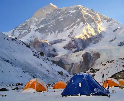
This is the day you would look forward to as we reach the Makalu Basecamp, the highest base camp on earth. From Sherson, we start walking, and the trail is left to our east. We climb down to a minor pass about 100 meters above Makalu Base Camp. We further go down, crossing over the boulders to reach the base camp on the river’s west bank. We can see the southern part of Makalu. A climb as tedious and exhilarating as this also yields the same kinds of rewards. From here, you can see the Mighty Himalayan peaks of Everest, Baruntse, Peaks 6 & 7, and also the Lhotse.
Location:
Makalu Base Camp
Duration:
4 to 5 hours
Meal:
Breakfast, Lunch & Dinner
Altitude Different:
5,000 meters
Accommodation:
Tea house / lodge
The base camp is barren land with the Barun Glacier away from it. From the spot, we can see the stunning south face of Makalu and the magnificent view of Everest and Lhotse. Similarly, we can explore the surrounding areas with lakes, glaciers and capture photographs and enjoy the remaining time.
Location:
Makalu Base Camp
Meal:
Breakfast, Lunch & Dinner
Altitude Different:
5,000 meters
Accommodation:
Tea house / lodge
Today we trek back to Nhe Kharka following the same trail that we had taken to reach the Makalu Base Camp.
Location:
Nhe Kharka
Duration:
6 to 7 hours
Meal:
Breakfast, Lunch & Dinner
Altitude Different:
3,000 meters
Accommodation:
Tea house / lodge
After a hearty and warm breakfast, we walk back to Mumbuk. Traversing through the Pine and Rhododendron forests, we will reach Mumbuk in the late afternoon to witness the beautiful sunset.
Location:
Mumbuk
Duration:
5 to 6 hours
Meal:
Breakfast, Lunch & Dinner
Altitude Different:
3,570 meters
Accommodation:
Tea house / lodge
Leaving Mumbuk, we trek across the Shipton La pass and start our descent towards Kauma. You will enjoy spectacular views at the pass with scenic landscapes. Once we reach Kauma, you can relax and sleep for the night.
Location:
Kauma
Duration:
5 to 6 hours
Meal:
Breakfast, Lunch & Dinner
Altitude Different:
3,470 meters
Accommodation:
Tea house / lodge
Today we climb down Tashi Gaon. Here we spend the rest of the day relaxing to catch up with the energy used to trek at the high altitude. You might be pretty exhausted, but we’re almost alive.
Location:
Tashi Gaon
Duration:
4 to 5 hours
Meal:
Breakfast, Lunch & Dinner
Altitude Different:
2,070 meters
Accommodation:
Tea house / lodge
From Tashi Gaon we go down to Sedua, and then follow the trails to further go down to Mulgaon. Leaving Mulgaon behind, we start walking down the steep rocky trail through fields of corn and barley until we reach the Ipsuwa Khola. Here we have to cross the suspension bridge and stop for lunch. This is the place from where we have entered the Arun Valley. The area is used as a temporary settlement by the farmers living up in the hills. Further down the trail and we reach Balung (760 m).
Location:
Balung
Duration:
5 to 6 hours
Meal:
Breakfast, Lunch & Dinner
Altitude Different:
760 meters
Accommodation:
Tea house / lodge
We start a bit late today as the trail is short to the village of Pukuwa. We walk past the Walung (880m) town predominated by the Rai community and then cross the Apsawa Khola. After a small climb, we will reach Chhayang village, a settlement of the Rai community. The trail then crosses a stream at 590m and makes some ups and downs to reach Parangbu, a delightful camping spot among rice fields on the banks of the Arun River. We walk through forests and pass several small streams to get to Pukuwa (550m).
Location:
Pukuwa
Duration:
5 to 6 hours
Meal:
Breakfast, Lunch & Dinner
Altitude Different:
550 meters
Accommodation:
Tea house / lodge
Passing some rocky terrain and green fields on the trail, we reach the village of Tome (520 m). Makalu Barun base camp trekking is famous for the mountains and their cultivation in such a remote and challenging terrain. Below Tome, the Arun Valley becomes broader and more U-shaped. The trail ascends over another ridge on a steep, narrow stairway cut out of rocks. From the top of the hill at 530m, the trail descends to a charming camp on the banks of the Sankhuwa Khola (370m), across from the Chhetri village of Bumling.
Location:
Bumling
Duration:
5 to 6 hours
Meal:
Breakfast, Lunch & Dinner
Altitude Different:
370 meters
Accommodation:
Tea house / lodge
Today is the last day of the trek, and we go down, following the river downstream to its confluence with the Arun River. Further on, we cross the Arun River and start walking on the east bank of the Arun, past the village of Chyawabesi, before climbing back to the Tumlingtar plateau. We walk on flat land to the hotel near the airport.
Location:
Tumlingtar
Duration:
3 to 4 hours
Meal:
Breakfast, Lunch & Dinner
Altitude Different:
460 meters
Accommodation:
Tea house / lodge
We take a flight back to Kathmandu which lasts for an hour.You can extend your trip by exploring the natural and cultural beauty of Kathmandu or rests of the day enjoy yourself.
Location:
Kathmandu
Duration:
1 hour (Flight)
Meal:
Breakfast & farewell Dinner
Altitude Different:
1,400 meters
Accommodation:
Hotel in Kathmandu
Price Includes
- Airport pick up and drop off, upon arrival and departure in Kathmandu (International and domestic both)
- Makalu Base camp all required permit fee and Makalu Barun National Park entrance fee
- Flight ticket to Tumlingtar both ways
- Food and accommodation during the trek and climb (full board with breakfast, lunch and dinner with tea/coffee and seasonal fresh fruits)
- One licensed English or Chinese or Korean or Hindi along with Nepali speaking trekking guide
- Transportation, food, accommodation and insurance of Guide during the trip
- Down jacket, all-season sleeping bag, duffel bag and trekking map(in case if you don't have your own. Down jacket, sleeping bag and duffel bag must be returned after completion of the trip)
- First Aid Medical Kit(Carried by the guide)
- First Aid Medical Kit(Carried by the guide) Aarogya PC-303 Portable Vital Signs Monitor Device
Price Excludes
- International Airfare
- Visa Charges
- Your travel and medical insurance
- Personal Expenses such as shopping, bar bills, hot shower, telephone, laundry, titbits etc
- Services not mentioned or not promised by the Agent / Agency
- Emergency expenses such as expenses on charted Flights / Helicopter
Add-ons & Options
1. Accommodation Booking in Kathmandu:
We can arrange your hotel stay in Kathmandu for a smooth and stress-free arrival.
✅ Double Room: USD 55 per night (cost can be shared between two trekkers)
✅ Single Room: USD 45 per night
📍 Centrally located near Thamel – close to gear shops, great restaurants, and cultural sites.
2. Private Jeep Transfer:
We offer comfortable and convenient round-trip private jeep services between Tumlingtar to Num and return to Tumlingtar from Tashi Gaun. You can return by flight from Pokhara to Kathmandu.
3. Porter Services:We can arrange a reliable, experienced porter to support your trek.
✅ Contact us for current rates and availability.
Don't hesitate to get in touch with us for current rates and availability.
Join Group Availability
Select a departure month
Select year
| Start | Finish | Availability | Price | |
|---|---|---|---|---|
| Saturday Aug 01, 2026 | Thursday Aug 20, 2026 | Trip Status Available | Starting from US$ 1,705 | |
| Thursday Aug 06, 2026 | Tuesday Aug 25, 2026 | Trip Status Available | Starting from US$ 1,650 | |
| Thursday Aug 13, 2026 | Tuesday Sep 01, 2026 | Trip Status Available | Starting from US$ 1,705 | |
| Saturday Aug 15, 2026 | Thursday Sep 03, 2026 | Trip Status Available | Starting from US$ 1,805 | |
| Saturday Aug 22, 2026 | Thursday Sep 10, 2026 | Trip Status Available | Starting from US$ 1,705 | |
| Sunday Aug 30, 2026 | Friday Sep 18, 2026 | Trip Status Available | Starting from US$ 1,805 | |
| Wednesday Sep 02, 2026 | Monday Sep 21, 2026 | Trip Status Available | Starting from US$ 1,705 | |
| Tuesday Sep 08, 2026 | Sunday Sep 27, 2026 | Trip Status Available | Starting from US$ 1,650 | |
| Monday Sep 14, 2026 | Saturday Oct 03, 2026 | Trip Status Available | Starting from US$ 1,705 | |
| Tuesday Sep 22, 2026 | Sunday Oct 11, 2026 | Trip Status Available | Starting from US$ 1,650 | |
| Friday Oct 02, 2026 | Wednesday Oct 21, 2026 | Trip Status Available | Starting from US$ 1,805 | |
| Saturday Oct 10, 2026 | Thursday Oct 29, 2026 | Trip Status Available | Starting from US$ 1,650 | |
| Thursday Oct 15, 2026 | Tuesday Nov 03, 2026 | Trip Status Available | Starting from US$ 1,705 | |
| Tuesday Oct 20, 2026 | Sunday Nov 08, 2026 | Trip Status Available | Starting from US$ 1,805 | |
| Saturday Oct 24, 2026 | Thursday Nov 12, 2026 | Trip Status Available | Starting from US$ 1,650 | |
| Tuesday Oct 27, 2026 | Sunday Nov 15, 2026 | Trip Status Available | Starting from US$ 1,805 |
If the above Makalu Base Camp Trek 20 Days
does not meet your needs, we can design individualized travel plans based on your preferences and
specifications.
Elevation Chart: Makalu Base Camp Trek 20 Days
Download
Altitude in:
FAQ's for Makalu Base Camp Trek 20 Days
General Information
A 20-day trek into the remote Makalu-Barun National Park, leading to the base of Mount Makalu (8,481m), the world’s fifth-highest peak, with dramatic landscapes, glaciers, and rich biodiversity.
Itinerary & Duration
The full itinerary is 20 days, including flights, trekking, and acclimatization days.
Transportation
The trek begins with a flight from Kathmandu to Tumlingtar, followed by a drive to Chichila, the trailhead.
Altitude & Safety
Makalu Base Camp at 5,250m is the highest point.
Accommodation & Food
Dal bhat, noodles, momo, Tibetan bread, soups, and occasional Western meals depending on lodge availability
Preparation & Gear
Challenging – suitable for experienced trekkers due to steep trails, long days, and high altitude.
Permits & Costs
Makalu-Barun National Park Entry Permit and a TIMS card.
Services & Guides
Yes, a guide is highly recommended for navigation, safety, and cultural insights.
Payment & Booking
You can book online with Nepal Lion Trekking or directly at the Kathmandu office.
Culture & Local Experience
You’ll encounter Rai, Sherpa, and Tibetan-influenced communities, with chances to visit monasteries and learn about mountain lifestyles.
Weather & Seasons
Spring (March–May) and Autumn (Sept–Nov) provide the best weather and mountain visibility.
Fitness & Health
Yes, previous high-altitude trekking experience is highly recommended for this trek.
Family & Group Trekking
Not recommended for young children; suitable only for adventurous families with older teenagers and trekking experience.
Sustainability & Environment
By reducing plastic use, managing waste responsibly, and supporting local tea houses and communities.
Review Requests
Enter a recent customer’s contact info and we’ll ask them to leave you a review.